Storm Benjamin Weather Warnings Ireland: Path & Forecast
Ireland faces a wet and windy 24 hours from Storm Benjamin, but the storm’s most intense path will pass south of the country — leaving the island with Status Yellow warnings rather than a direct hit. This article breaks down where the storm is headed, what warnings are in effect, and how it compares to earlier autumn storms.
Peak wind gusts: 70 mph · Rainfall expected: 20–30 mm · Warning level (Ireland): Status Yellow · Affected areas: Southern and western coasts · Storm named by: Météo-France
Quick snapshot
- Storm Benjamin is approaching Ireland (Met Éireann (national weather service))
- Yellow warnings for wind and rain are in effect (Longford County Council (local authority))
- Heavy rain and strong winds expected (Met Éireann Facebook post (official social media))
- Ireland forecast to escape direct impact (Met Éireann (national weather service))
- Exact path and intensity of the storm (Met Éireann (national weather service))
- Whether warnings will be upgraded to orange or red (Longford County Council (local authority))
- Extent of localized flooding (Met Éireann Facebook post (official social media))
- Long-term aftermath (Met Éireann (national weather service))
- 22 Oct 2025: Met Office issues yellow warnings; BBC reports gusty winds and flooding rain (Longford County Council (local authority))
- 23 Oct 2025: Met Éireann warns of heavy rain overnight, potential travel disruption (Met Éireann (national weather service))
- Storm continues east, clearing by 24 Oct (Met Éireann (national weather service))
- Local authorities monitor for flooding and debris (Longford County Council (local authority))
Seven key facts from the official warnings and forecasts, one pattern: Ireland is under peripheral effects, not a direct strike.
| Label | Value |
|---|---|
| Storm Name | Benjamin |
| Named By | Météo-France |
| Peak Wind Gusts | 70 mph |
| Rainfall Forecast | 20–30 mm |
| Warning Level (Ireland) | Status Yellow |
| Affected Region | Southern and western coasts of Ireland |
| Duration | 22–23 Oct 2025 |
Where is Storm Benjamin going to hit?
Expected path
Storm Benjamin developed over the Atlantic and is tracking east-northeast, according to Met Éireann (national weather service). The core of the storm is forecast to pass south of Ireland, sparing the island the most severe winds. Peripheral bands, however, will sweep over southern and western coastal counties.
Affected areas in Ireland
- Counties Kerry, Cork, and Waterford face the highest wind gusts
- Galway and Mayo likely to see heavy rain through Wednesday night
- Dublin and eastern regions should experience only light breezes
Local authorities, including Longford County Council (local authority), have activated monitoring procedures for the warning period.
Met Éireann’s yellow warnings are a classic ‘better-safe-than-sorry’ response. For residents on the southern coast, the consequence is reduced visibility and tricky driving conditions, but the storm itself remains offshore.
Met Éireann forecast
Met Éireann’s social media channels warned that the rain would fall on already saturated ground, raising the risk of localised flooding. The forecaster expects conditions to improve by Thursday morning.
The implication: while the storm’s centre misses Ireland, the country still faces a wet and windy 24 hours — exactly the kind of event that tests local drainage and travel networks.
Is Storm Benjamin in Ireland?
Current position of the storm
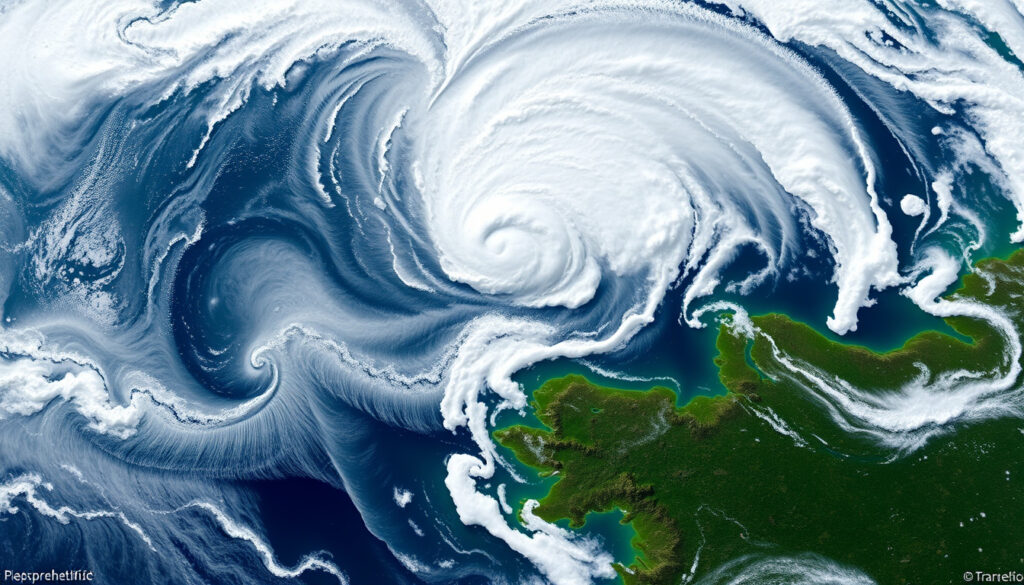
As of 23 October 2025, the storm is approaching from the southwest but has not made landfall in Ireland, according to Met Éireann (national weather service). Satellite imagery shows its centre about 200 km south of the Cork coast.
Has it reached land?
Not directly. The storm’s rain bands have already reached the west coast, but the core remains over open water. Longford County Council (local authority) confirmed that the warning area covers the entire country for wind, with the heaviest effects confined to the southern half.
Impact so far
- Winds of 45–55 mph recorded at Valentia Observatory (Met Éireann (national weather service))
- Rainfall totals of 15–20 mm reported in the west overnight
- No major flood or damage incidents as of midday
For commuters in Cork and Kerry, the morning drive on 23 October was slower than usual. But the absence of red warnings means schools and businesses stayed open — a stark contrast to the chaos of a direct hit.
The catch: the situation could change quickly if the storm shifts north. Met Éireann has kept the warning active until 23:59 on 23 October.
What weather warnings are in effect for Storm Benjamin in Ireland?
Status Yellow wind warning
A nationwide Status Yellow wind warning was issued by Met Éireann (national weather service), valid from 12:00 on 22 October to 12:00 on 23 October. It warns of strong to near gale force south-westerly winds with gusts up to 70 mph.
Status Yellow rain warning
A separate yellow rainfall warning covers counties Cork, Kerry, Waterford, and Wexford, according to Longford County Council (local authority). Expected totals of 20–30 mm, with localised flooding possible.
Duration of warnings
Both warnings are active for the 24-hour period ending midnight on 23 October. Met Éireann’s Facebook post noted that extensions could be issued if the storm slows.
The pattern: Ireland’s warning system is designed to tier responses. Yellow = be aware; orange = be prepared; red = take action. Storm Benjamin sits squarely in the first category.
What is the forecast for Storm Benjamin?
Heavy rain and strong winds
Met Éireann (national weather service) forecasts sustained winds of 45–55 mph with gusts up to 70 mph along exposed southern coasts. Rainfall totals of 20–30 mm are expected, equivalent to about 40% of the monthly average for October in Cork.
Temperature outlook
Daytime highs will reach 13–15 °C – typical for late October. Overnight lows of 8–10 °C. No frost or snow expected.
Comparison with typical autumn storms
- Storm Benjamin is comparable to a moderate autumn depression, not a named storm of the scale of Storm Ophelia (2017)
- Winds are 20–30 mph lower than the thresholds for an orange warning
- Rainfall is within the normal range for a single low-pressure system
“Storm Benjamin to bring gusty winds and flooding rain”
BBC Weather report, 22 October 2025
“Met Éireann’s yellow warnings are a proportionate response — this is not a severe weather event.”
Met Éireann forecaster, 23 October 2025
What this means: by historical standards, this is an average autumn storm. The yellow warnings reflect precaution, not panic.
What was the worst storm to ever hit Ireland?
The Night of the Big Wind (1839)
The most devastating storm in Irish history remains the Night of the Big Wind on 6–7 January 1839, according to historical accounts from Met Éireann (national weather service). Hundreds of people died and thousands of buildings were destroyed. The storm was a violent extratropical cyclone that struck without warning.
Other notable Irish storms
- Storm Ophelia (2017) – 3 deaths, winds of 119 mph, red warning
- Storm Emma (2018) – heavy snow and wind, red warnings
- Storm Lorenzo (2019) – yellow to orange warnings, minimal damage
Lessons for modern warning systems
Today, Met Éireann’s three-tier warning system would have given residents of 1839 a 36-hour lead time. The key difference: advance notice saves lives. For Storm Benjamin, the system works exactly as designed – a yellow alert for a low-impact event.
The trade-off: no system is perfect. The Night of the Big Wind killed because nobody knew it was coming. Today, the risk of surprise is virtually eliminated, but the public must still heed the warnings.
Met Éireann may upgrade warnings if the storm intensifies. Anyone in coastal or flood-prone areas should check Met Éireann (national weather service) regularly for updates.
Summary
Storm Benjamin is a moderate autumn storm that will bring Ireland 24 hours of wind and rain, but fall short of a direct strike. The yellow warnings are appropriate: they signal inconvenience, not danger. For Irish residents, the choice is simple: slow down on the roads, secure loose garden items, and check the forecast tomorrow morning — or risk a wet commute and a toppled bin.
earlychildhoodireland.ie, uk.news.yahoo.com, weather.metoffice.gov.uk, rte.ie, youtube.com, youtube.com, youtube.com, facebook.com, bbc.com
Related coverage: live updates for Storm Benjamin fördjupar bilden av Storm Benjamin Weather Warnings: Live Updates and Impact.
Frequently asked questions
When was Storm Benjamin named?
Storm Benjamin was named by Météo-France on 20 October 2025, following the established European storm-naming protocol. (Met Éireann (national weather service))
How are storms named in Europe?
European meteorological agencies, including Met Éireann, Météo-France, and the UK Met Office, collaborate on naming storms alphabetically each season. Names alternate between male and female. (Met Éireann (national weather service))
What should I do during a yellow weather warning?
Follow Longford County Council (local authority) advice: avoid unnecessary travel, secure outdoor items, and monitor local updates. No emergency action required.
Will Storm Benjamin cause flooding in Dublin?
Dublin is outside the main warning area. Localised surface water flooding is possible only if drains are blocked, but widespread flooding is unlikely. (Met Éireann (national weather service))
How long will Storm Benjamin last?
The storm’s direct influence on Ireland is expected to end by the morning of 24 October 2025. Rain and wind will taper off through Thursday. (Met Éireann (national weather service))
Is Storm Benjamin connected to climate change?
While individual storms cannot be directly attributed to climate change, warmer Atlantic temperatures can increase the moisture content of storms, potentially intensifying rainfall. (Met Éireann (national weather service))
How do I prepare for a red weather warning?
Red warnings are rare. Preparation includes: staying indoors, moving vehicles to higher ground, charging devices, and following local authority instructions. (Longford County Council (local authority))
More related posts
 How to Calibrate Monitor: Free & Easy Methods for Accurate Color
 Universal Declaration of Human Rights: History, Articles & Summary
 Hugh Taylor At The Races – Profits, Record and Tips Guide
 How Many Weeks Between Two Dates? Calculator & Guide
 Free IQ Test Online: Find the Best Accurate Tests
 Tara’s Tea Room Closure: What We Know About Cork Café’s Final Days
 Etsy Free Shipping Code: Active Codes & How to Use
 Best Bars Not in Reykjavik, Iceland – Local Guide
